
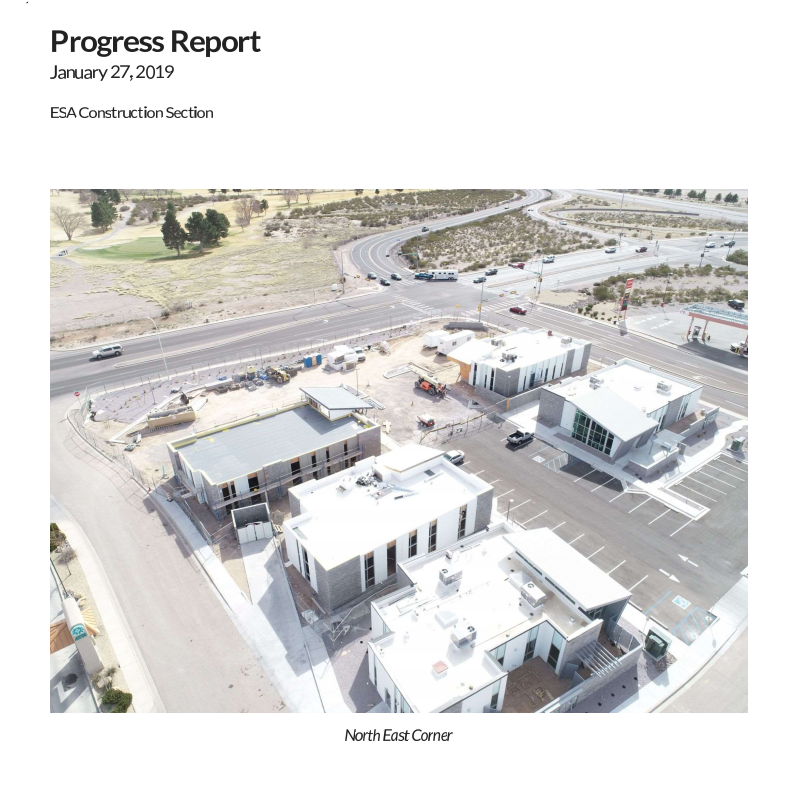
For stakeholders, getting a weekly view of how the project is going can be priceles information. Drone technology can fly the same flight plan week after week showing progress from corners of the project and also from a top down map view.
Get insights into the progress of your project and help visualize issues early before they become expensive mistakes
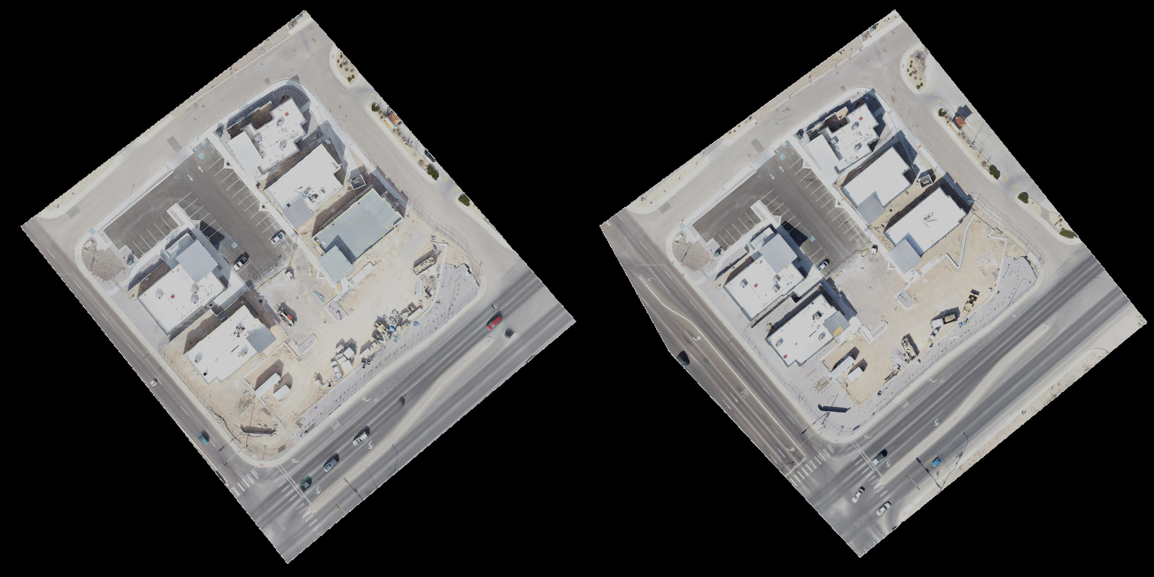

Below we have a Neighborhood park being built in a new subdivision. This one flight took 15 minutes and captured the entire area as it was on that day, additonally eleveation data was captured as well as the ability to measure 2D distances.
This is the bare orthomosaic. These maps can become even more accurate with the usage of ground control points and manual tie points.
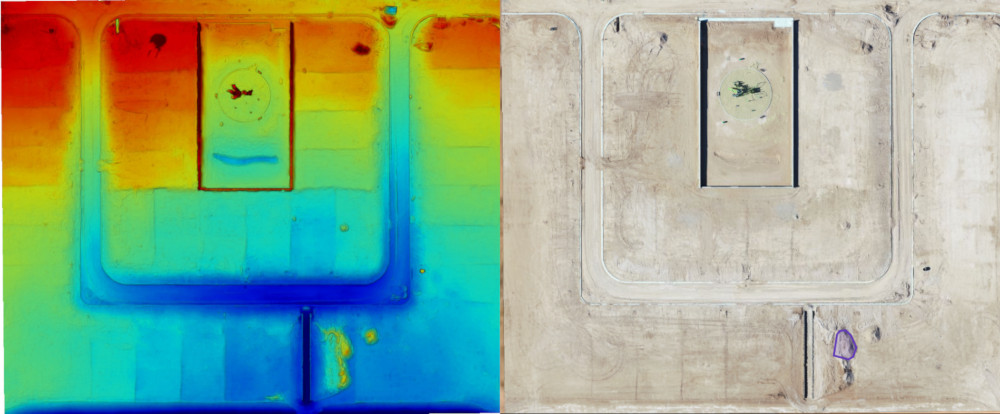
Drone flights can also gather accurate volumetrics. Though their vertical accuracy is a lot higher when Ground Control Points are placed at numerous areas areound the site. We work with surveyors to tie the data together.
Utilizing GPS technology, these maps can be orthorectified and also loaded into GIS and BIM software for use before, during and after the construction project has finished.
